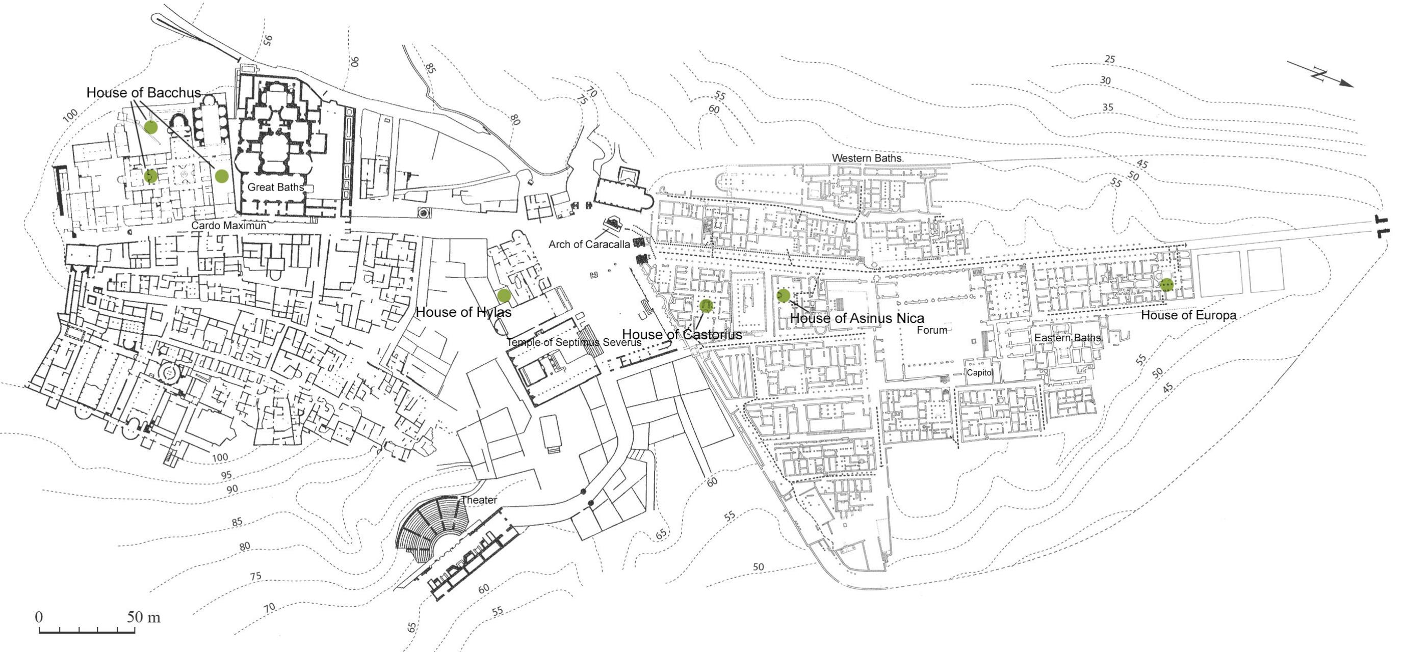
The city of Cuicul, modern Djemila in Algeria, was a Roman colony founded by Trajan at the beginning of the second century. It was located near the western frontier of Numidia, at a crossroads near the High Plain of Setif and quite south of the actual "Little Kabylie" region. The original city center was constructed on a spur set between two merging wadi, the Gergour and the Betame, at an altitude of about eight hundred meters above sea level, surrounded by mountains more than a thousand meters above sea level. There are snow falls and freezing cold in winter and plenty of water. For the most part, the climate exc1udes plants which cannot stand the frost; however, we can infer the presence of olive plantations due to the number of olive presses found throughout the town.
Images
Plan of Cuicul
Credit: AOROC, from Février, P.-A., Blanchard-Lemée, M., 2019, fig. 1a
Like several peristyle houses of the ancient part of Cuicul, the house of Asinus Nica, about 870 square meters in size, was inhabited and transformed from the second to the fifth ...
The large block of buildings called the "House of Bacchus", (about 7000 m2) has three separated gardens A, B, C and a peristyle VI. This site has been excavated during four ...
This house of irregular shape (Plan view, Fig. 1), rested against the ancient city wall, transformed into a decorative wall for the Severian Forum, and between two large cardines....
The block of buildings termed the House of Europa, about 1500 square meters in area, extends along the main Cardo, quite over the north gate of the town. It included large and ...
This small, irregular house, resting against the west wall of the judicial basilica, was found in a ruined state in 1938.
On the side of the corridor leading from the Severan ...
The garden A mentioned as an open area was excavated in 1930-1931 and in 1944 (Plan view, Fig. 1). It was enclosed on the N, by the Small Baths I (covered in a later period by ...