Hispania Tarraconensis / Emporiae
House of the L-shaped Cistern
This house, which was also set against the lower edge of the city near the port, was excavated in 1924 and 1935. It had been much altered by burials in late antiquity. Its large ...
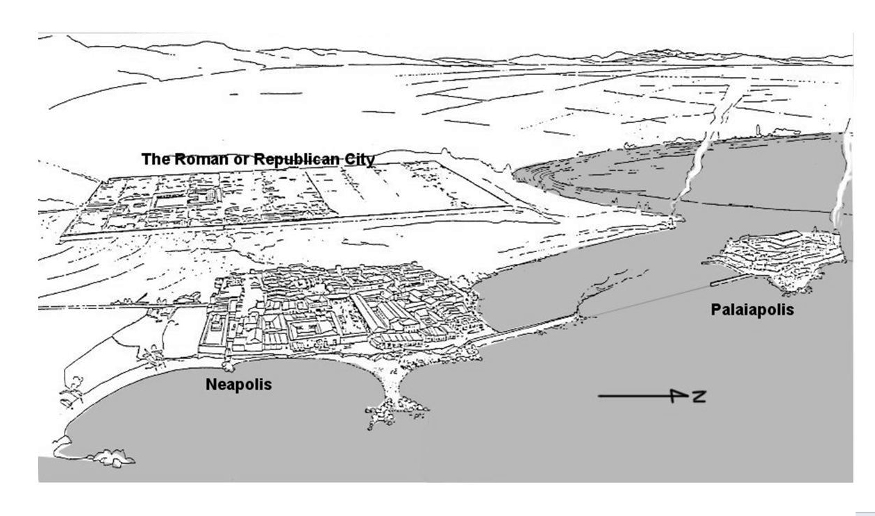
As Strabo (3.4.8) tells us, Greeks from Phokaia, by way of Massalia (Marseilles), established a market town (Emporion) here. Archaeology gives a date of approximately 575 - 550 BCE. The original settlement was on an island in the mouth of the Fluvià River. About 550, the settlement began to spread south onto the mainland, and the original settlement became known as Palaiapolis, the Old City. For clarity, archaeologists have given this Greek settlement on the mainland the corresponding name of Neapolis, New City. The plural form of the Latin name for the area – Emporiae, “markets” – reflects the dual nature of the city. Though literary sources mention other Greek settlements along the coast of the Iberian Peninsula, this is the only one known archaeologically.
Not only was Emporion the point of first contact between the Celtoiberians and Hellenic civilization, it was also here that, in 218 BCE, Roman armies first entered Iberia. The Roman consul Publius Cornelius Scipio reached Massalia too late to intercept Hannibal on his march into Italy, so he dispatched his brother Cnaeus with part of his forces to Emporion to cut Hannibal's supply lines, while he himself returned to engage the Carthaginian in the Po valley.
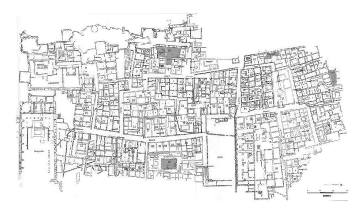
Neapolis was settled from north to south. The oldest parts date from before 550 BCE. The oldest part of the city wall come from 450 – 425 BCE. The Asklepion in the southwest corner was built in the 400 - 350 BCE period, as a reorganization of an older sanctuary. In the years 375 – 350 BCE, a new wall extended farther south. The second century BCE saw major building programs. The wall was again extended southwards. A new agora was formed, and the Asklepion reorganized. Public baths were built in the northeastern part of the city about 100 BCE. A Serapium was built in the southeastern corner in the first century BCE. Around 100 BCE, a Roman city surrounded by a wall (750 x 350 m) was built on a hill about 150 meters west of Neapolis where there had previously been a structure that was probably the Roman praesidium. We will refer to this area as the Roman City; it is also called the Republican City. Streets were laid out in a rectangular grid, and a large forum occupied the center of the southern half. Just outside the south wall were an amphitheater and a palaestra. Three large houses, two of them with gardens, have been found northeast of the forum and one to the southeast of it. The northern half of the city remains unexcavated. Once development of the Roman City began, Neapolis seems to have been little changed. The two walls between them were dismantled, but – rather strangely – replaced by a single wall, probably in connection with the creation of the Municipium Emporiae in about 36 – 27 BCE.
Neapolis was abandoned in the course of the second half of the first century CE. The Roman City seems to have ceased development at about that time but remained inhabited to nearly the end of the third century. This abandonment of a once-thriving trading town is probably connected with the silting up of the harbor. The mouth of the Fluvià River has shifted seven kilometers to the north, while Palaiapolis, once an island, is now a hill rising out of lowland where the harbor once was.
Publicly funded excavation of the northeastern part of Neapolis and the forum of the Roman City was conducted from 1846 to 1848. Further systematic studies were conducted from 1908 to 1936 under E. Gandía, who took a great interest in stratigraphy before it was common to do so. The Spanish Civil War brought this work to an end, but Gandía's day books have been preserved. Work was resumed in the 1940s and 1950s by M. Almagro, with recent work by R. Mar and J. Ruiz de Arbulo, and B. Tang. Tang emphasizes that it is often difficult or impossible to determine whether a space in a house in Neapolis was open or covered. The difficulty should not be so great in the case of gardens, for any sort of paving or hammered earth rules out the possibility of a garden. She identifies gardens in N5 and N7 and notes that also N 52 near the northern end of the western edge and N 75 on the northern edge “appear to have been provided with gardens or terraces.”