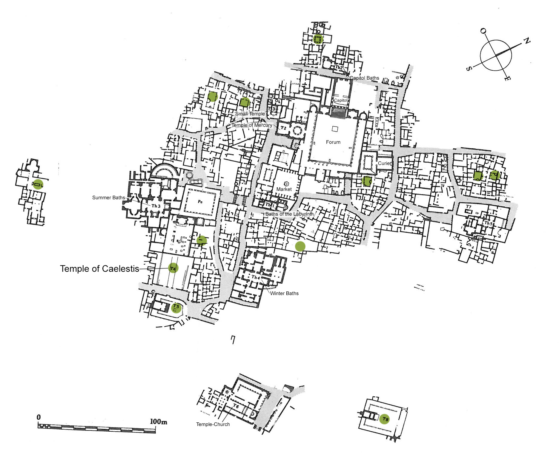
Temple of Caelestis (Temple de Caelestis)
Location
Location Description
The city occupies the slopes of a hill in a fertile grain producing area about 50 kilometers to the south of Tunis. Originally a settlement of mercenary soldiers after the fall of Carthage, it was raised to a municipium by Hadrian (117-138), and to a colony during the rein of Commodus (177-192). The chief public buildings and the most beautiful homes date from this period. After the crisis of the Empire during the third century, Thuburbo saw a rebirth in the fourth century; but as imperial authority declined the city became a mere village.
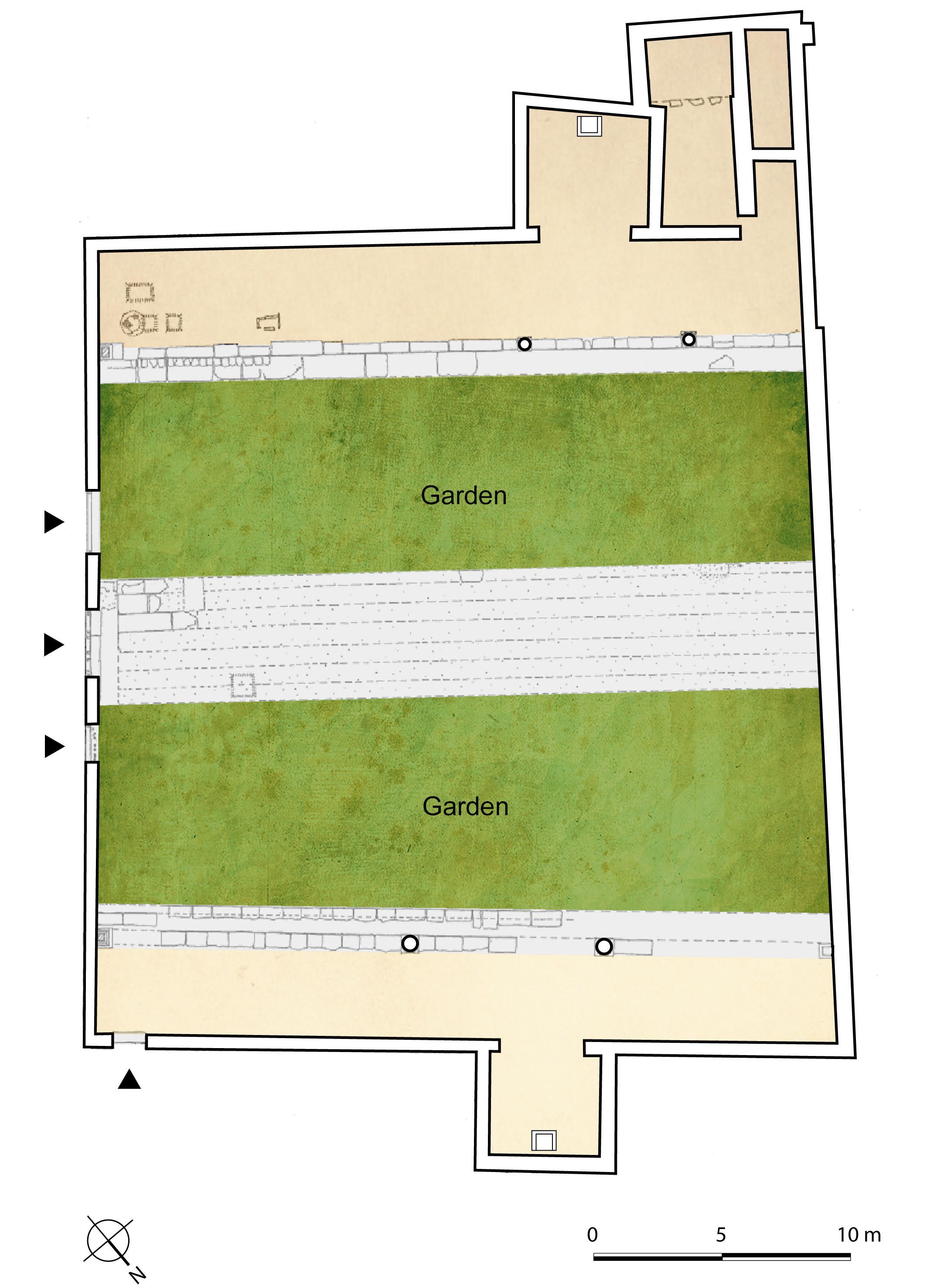
Garden
Temple of Caelestis (Temple de Caelestis)
Keywords
- temples (buildings)AAT:300007595
- sanctuaries (religious building spaces)AAT:300004575
- courtyards (uncovered spaces)AAT:300004095
Garden Description
The marble causeway leading to the temple was bordered on each side with soil that was probably planted as in temple E (Plan view, Fig. 1).
Plans
Dates
unspecified
Bibliography
- Ben Abed-Ben Khader, A., Corpus des Mosaïques de Tunisie, Thuburbo Majus, Les mosaïques de la région des Grands Thermes, V. II, fasc.2, INA, Tunis, 1985, pp. 47-9, plan 9. (worldcat)
- Ben Abed-Ben Khader, A., Corpus des Mosaïques de Tunisie, Thuburbo Majus, Les mosaïques de la région Ouest, V. II, fasc.3, INA, Tunis, 1987.(worldcat)
- Malek, A.-A., "Le jardin dans les sanctuaires du Maghreb romain, premières approches", in Du culte aux sanctuaires : l'architecture religieuse dans l'Afrique romaine et byzantine, Brouquier Reddé, V., Baratte, Fr., Rocca E. (dir.), Paris, de Boccard, coll. Orient et Méditerranée, 2018, pp. 213-230, 360, pl. 10. (worldcat)