Shrine Complex in Insula E125
Location
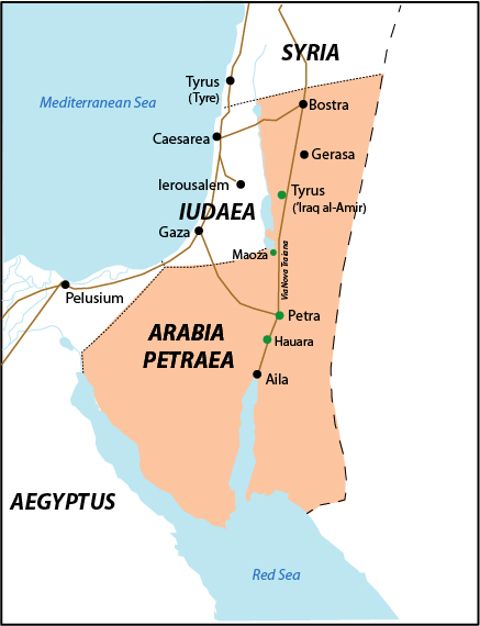
Nabataean Hawara (Auara) was founded by king Aretas III in the early first century BCE as a trading post along the King's Highway, midway between the Nabataean capital, Petra, and the port town of Aila on the Gulf of Aqaba (Fig. 1). In the early 2nd century CE, under Roman occupation, a fort was erected at the site (Roman Hauarra/Havarra) due to its strategic position on the major trade highway that was rebuilt as the Via Nova Traiana. Associated with the fort was a small town with a bathhouse and a community shrine. The modern name for the site is Humayma.
Garden
Shrine Complex in Insula E125
Keywords
- aqueductsAAT:300006165
- baetylsAAT:300400603
- basins (vessels)AAT:300045614
- insulae (apartments)AAT:300000325
- naoi (chambers)AAT:300004658
- planters (containers)AAT:300237566
- shrines (structures)AAT:300007558
- temeneAAT:300000805
Garden Description
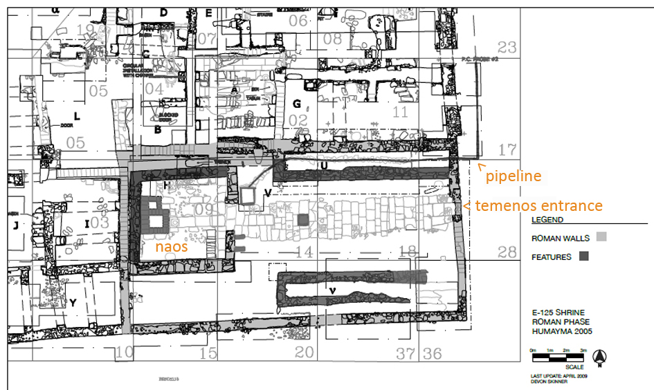
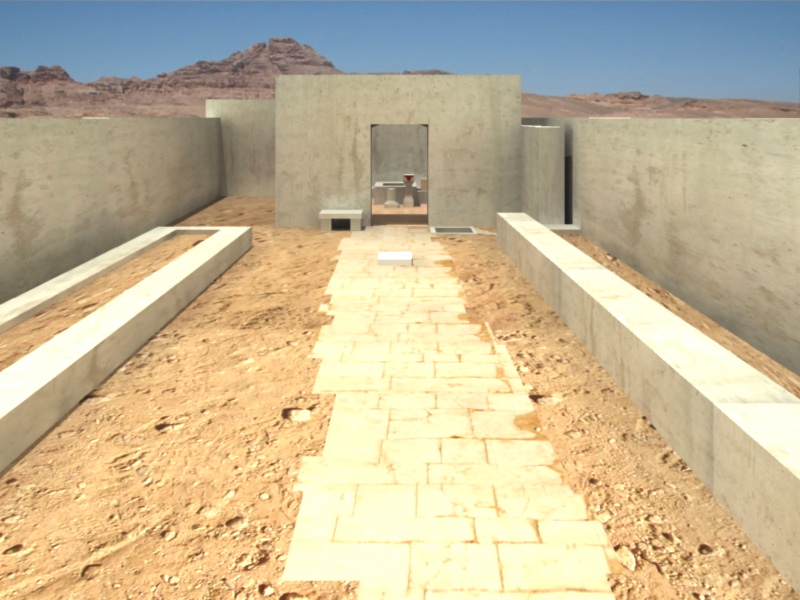
A few decades after a Nabataean shrine (Fig. 2) at Hauarra had been severely damaged during the Roman conquest of Arabia Petraea, the site's inhabitants built another shrine at the same location. The Roman-period shrine occupied the southeast corner of a multi-unit insula (E125), but could only be accessed from outside the complex. This shrine consisted of a square naos (containing a central Nabataean baetyl and legionary altar, bins, shelves, and votive offerings) enclosed in a rectangular open-air temenos (Fig. 3). Upon entering the temenos, worshippers walked to the naos along a 12.7 m long paved processional way that was flanked by two long raised planters. An aqueduct-fed basin next to the door of the naos appears to have supplied the shrine with so much fresh water that it must have been intended not just for ritual cleansing, but for supplying the planters as well. Given the relatively shallow depth of the planters, and that no root balls or pots were found within, they probably contained shrubs and/or flowers rather than trees. Although the architect clearly tried to make the planters symmetrical in size, shape, and location, their design (and that of the whole Roman shrine) was constrained by the reuse of some Nabataean walls as foundations.
Maps
Plans
Images
Dates
1st century CE, mid-2nd to 3rd century CE
Bibliography
- Oleson, J. P., M. B. Reeves, G. S. Baker, E. de Bruijn, Y. Gerber, M. Nikolic, and A. N. Sherwood. 2008. "Preliminary Report on Excavations at Al-Humayma, Ancient Hawara, 2004 and 2005." Annual of the Department of Antiquities of Jordan 52: 309-42. (Stable URL).
- Reeves, M. B. 2019. "A Nabataean and Roman Shrine with Civic and Military Gods at Humayma, Jordan." Arabian Archaeology & Epigraphy 30 (1): 134-55. (DOI).