House C, Les Villégiales, quarter of the Benedictines
Province
Province Description
Ancient Roman colony (founded 118 BCE) and senatorial province located in modern southern France, along the Mediterranean. This province had stronger cultural and political ties to Italy than the rest of Gaul.
Location
Sublocation
House C, Les Villégiales, quarter of the Benedictines
House
House C, Les Villégiales, quarter of the Benedictines
Keywords
House Description
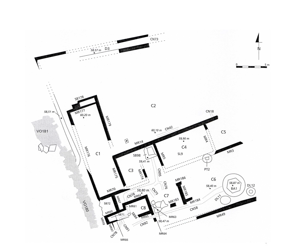
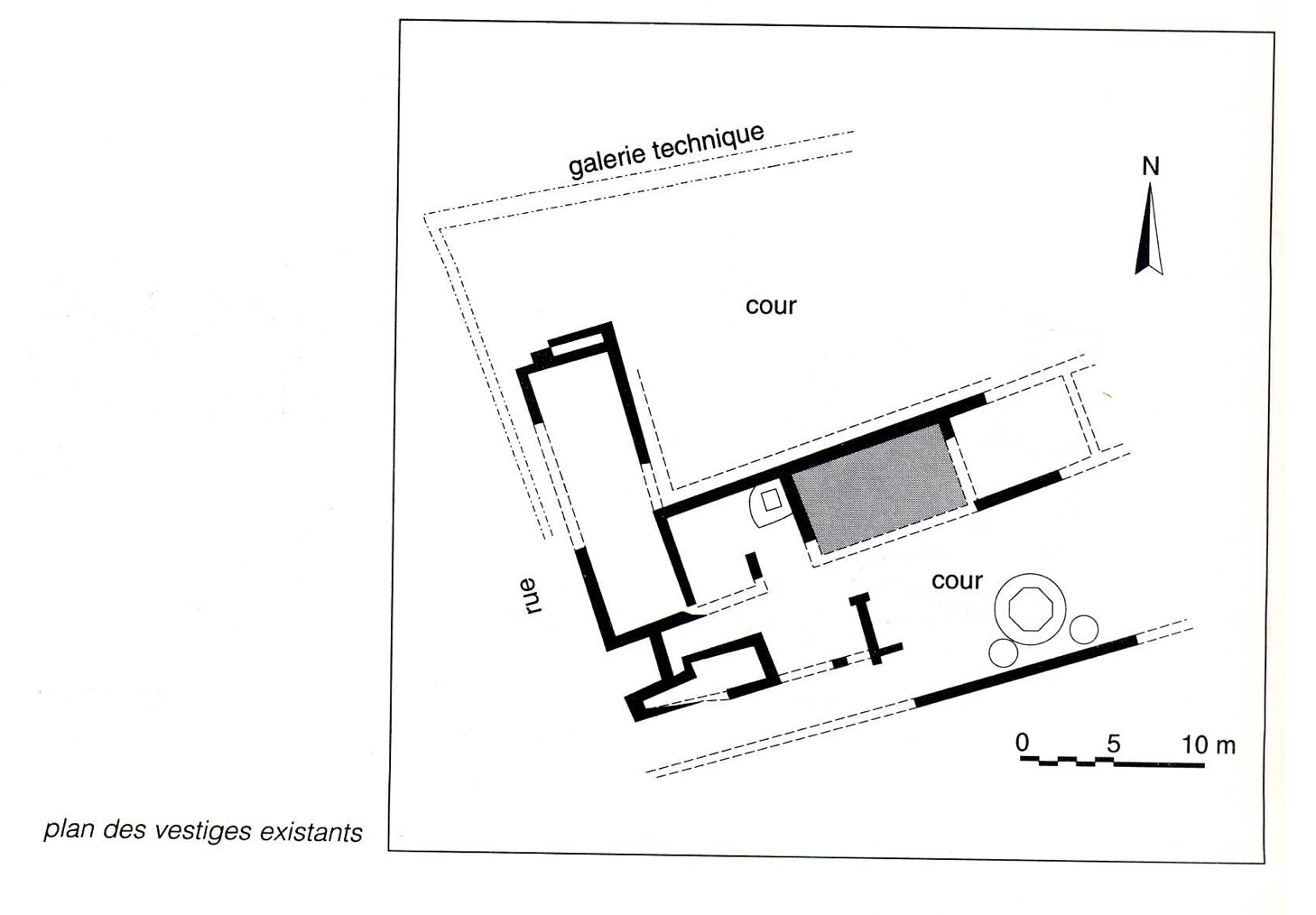
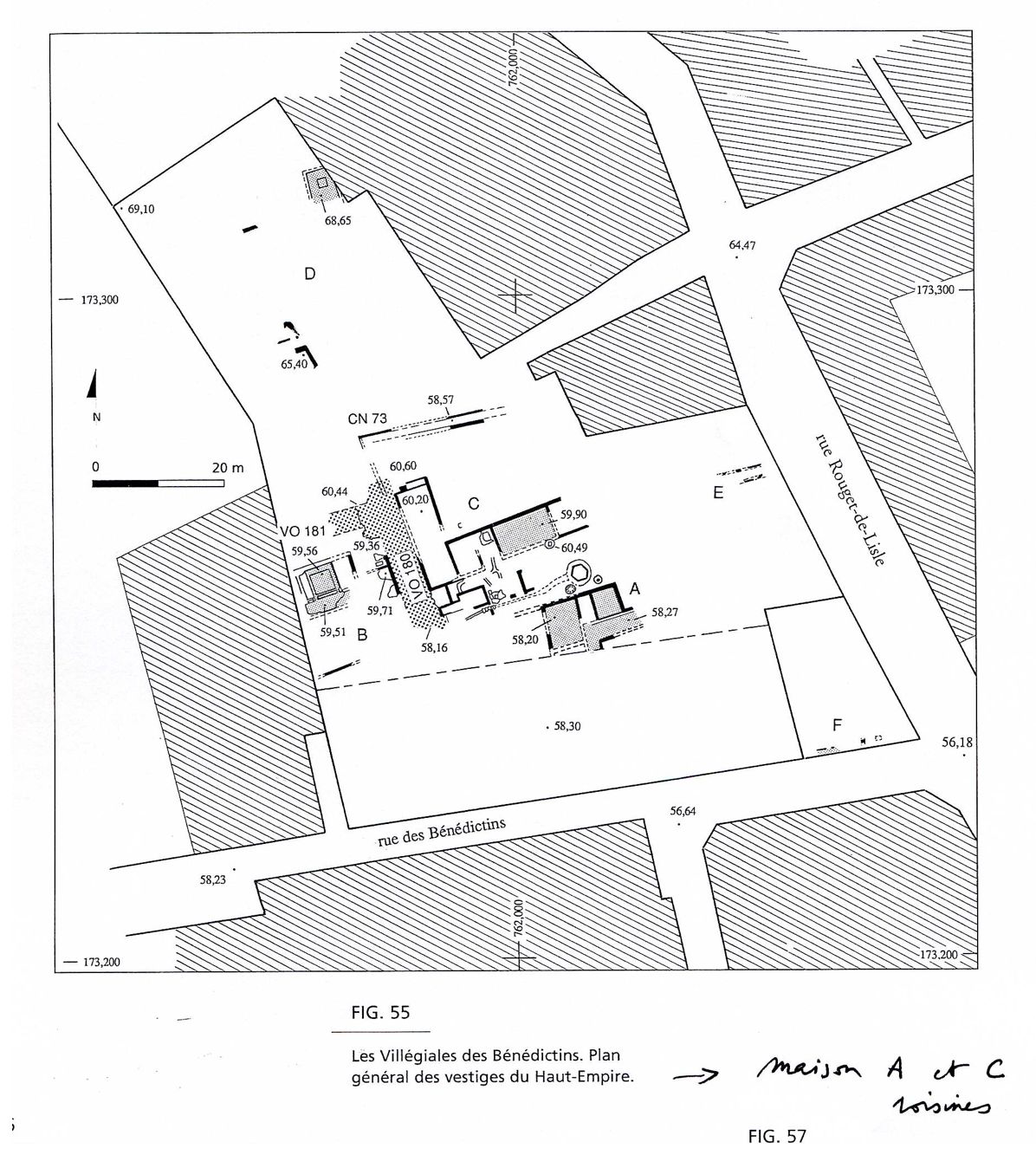
House C is 300 meters east of the source of the big spring at the foot of Mt. Cavalier, at the northwest point of an block of houses and bordered by a north-south road paved with flagstones. Built during the years A.D. 40-60, it seems to have been occupied until the middle of the second century. {I do not understand "IIe dernier": "the second last." ???} The surface explored during the salvage excavations in 1991 covers about 810 square meters, with about 300 square meters of useful covered surface. The eastern part is unknowable because of destruction by modern operations. This part would have brought the total surface to more than 1000 square meters. How the whole of the place worked together remains, however, very hard to follow, for there has been an almost total loss of the floors and thresholds of the living areas. At a break in the slope of the land on the north side was placed a utility tunnel with lead pipes for bringing in running water. It defines the northern limit of the house. On the south, a courtyard [1], associated with a frequently rearranged zone [2] was bordered on the north by a series of three rooms with floor levels differing by 70 cm to 1 meter. Such a pronounced difference in levels would imply stairs in front of these spaces, but none has been found. This courtyard of at least 111 square meters yielded only a few traces of the paleosol on the bedrock. In a circular pit 3.90 meters in diameter and a little off-center to the south, was a pool. While the outside was circular, the inside – the space filled with water -- was a hexagonal with 1.2 meter sides. Its 40-cm deep inside was lined with hydraulic cement, and its bottom rested on a series of limestone flagstones which seem to plug a round cistern (1.18 meters in diameter) which belonged to an earlier condition of the house. Flanking the pool on either side, two dolia {(large, ceramic, roughly spherical tanks)} may have stored water or served as planters.
Plans
Dates
A.D. 40-60 Built
Bibliography
J.L. Fiches, A. Veyrac, Nîmes, CAG, 30/1, 1996.
P.Gros, J. Guyon, Ph. Leveau, dir.,La maison urbaine d'époque romaine, Atlas des maisons de la Gaule narbonnaise, t. II, Doc. d'Archéol. Vaucl, 6, 1996, Nîmes, fiche n°6 P. 202-203.(worldcat)
M. Monteil, Nîmes antique et sa proche campagne, Monographie d'Archéologie Méditerranéenne, 3, 1999, P. 130-139.(worldcat)
Garmy, Pierre, and Martial Monteil. Le Quartier Antique Des Bénédictins À Nîmes (gard): Découvertes Anciennes Et Fouilles, 1966-1992. Paris: Editions de la Maison des sciences de l'homme, 2000, P. 74-76, P 83-88.(worldcat)
Places
- Narbonensis (province) Pleiades: 981537
- Gallia Narbonensis (province) TGN: 7030317
- Nîmes (inhabited place) TGN: 7008371