House of Nicentus (Maison de Nicentus)
Province
Africa Proconsularis
Africa proconsularis (Pleiades)
Province Description
The history of Roman Africa begins in 146 BC with the destruction of Carthage and the establishment of the province of Africa in the most fertile part of the Carthaginian Empire. The new province covered about 5000 square miles (17,172 square kilometers) of the northern part of modern Tunisia. A praetor governed the area from his headquarters at Utica. The Romans inherited a thriving agriculture developed by the Carthaginians. The climate was hospitable. Wheat and barley were the most important cereals; wine and olive oil were also produced and there were various fruit trees.
Location
THUBURBO MAIUS (Henchir Kasbat), Tunisia
THUBURBO MAIUS (Henchir Kasbat), Tunisia (Pleiades)
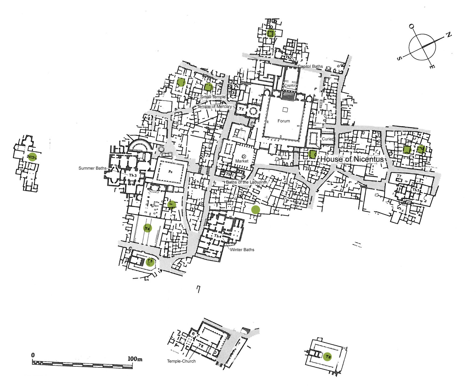
Plan of Thuburbo Maius (CMT, Thuburbo Majus)
Location Description
The city occupies the slopes of a hill in a fertile grain producing area about 50 kilometers to the south of Tunis. Originally a settlement of mercenary soldiers after the fall of Carthage, it was raised to a municipium by Hadrian (117-138), and to a colony during the rein of Commodus (177-192). The chief public buildings and the most beautiful homes date from this period. After the crisis of the Empire during the third century, Thuburbo saw a rebirth in the fourth century; but as imperial authority declined the city became a mere village.
Garden
House of Nicentus (Maison de Nicentus)
Keywords
Garden Description
The house is adjacent to the E angle of the Forum at the back of the Curia.
It was laid out around a peristyle garden (VI-X) of 12 columns (Plan view, Fig. 1). A low wall separated the porticos from the garden. Two semicircular pools projected into the garden; they were located in the axis of two reception rooms. The largest of the pools faced the oecus (XIV); its bottom was paved with a fish mosaic and the inside depicted putti boating and swimming. The second basin on the SE side faced room XI.
Maps
Plans
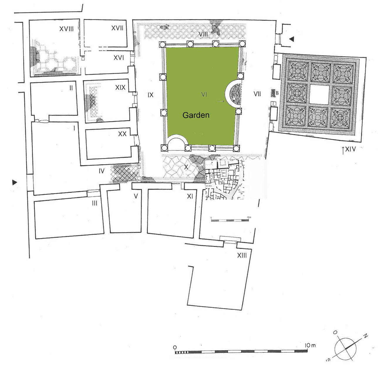
Fig. 1: Plan of the House of Nicentus ( CMT, V. II, fasc.1, plan 10-11)
Dates
3rd-4th century CE
Bibliography
- Alexander, Margaret A., Corpus des Mosaïques de Tunisie, Thuburbo Majus, Les mosaïques de la région du Forum, V. II, fasc.1, INA, Tunis, 1980, pp. 39-52, plan 10-11 (worldcat)
- Ben Abed-Ben Khader, A., Corpus des Mosaïques de Tunisie, Thuburbo Majus, Les mosaïques de la région Ouest, V. II, fasc.3, INA, Tunis, 1987.(worldcat)
- Bullo, S. and F. Ghedini,. Amplissimae atque ornatissimae domus: l’edilizia residenziale nelle città della Tunisia romana, Rome: Edizioni Quasar, 2003, pp.221-223. (worldcat)
Pleiades_ID
TGN ID
Contributor
Publication Date
21 Apr 2021